Of ancient maps and modern times
Travelers need directions. Once stashes of paper maps helped drivers find destinations, today most everyone relies on GPS navigation. It’s handy, fast and available – unless it’s not and and then you’d give the world for an old-fashioned, fold-out map.
It wasn’t that long ago that maps and charts were possessions which could make the difference between life and death. History is littered with shipwrecks and pirates; trade route skirmishes and religious battles – all resulting from lines drawn on paper.
There’s nostalgia now for maps. Whether you were introduced to the wonder of them as a child and poured over National Geographic Atlas; or you simply loved helping your parents navigate on family road trips, maps may be dear to your heart.
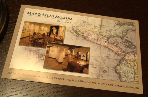
Take that love of illuminated directions to its zenith and meet Michael Stone, the founder of the La Jolla Map Museum. Stone has parlayed his affection into a collection of over 500 maps and atlases that span the 1400s to mid-1900s, and most hold critical importance in historical or political contexts.
His love of old maps led him to befriend Barry Ruderman, who is considered “the largest online antiquarian map seller in the world,” and Daniel Crouch, who created the map and atlas department of Bernhard Shapero Rare Books in London. Both spoke at the opening of Stone’s La Jolla Map Museum last year and have helped direct his acquisitions.
Today the museum is open and free by appointment. Retired Naval Officer, Captain Richard Cloward is the Director and should you be fortunate to meet at the museum, he’ll share his enthusiasm for the exhibits with encyclopedic knowledge. Rosalind Gibson is the Assistant Director of the museum and ushers groups of school children through the space each week.
Whatever may draw you into the La Jolla Map Museum, it’s a wonder to stand in front of the ink renderings of Benjamin Franklin, to be inches from Ptolemy’s first ideas of the earth’s girth and the graphic illustrations of “Jacinto 'Jo' Mora." The latter inspired several rock albums from the 1970s and looks surprisingly similar to the comic works of Robert Crumb. Jo Mora’s maps are being featured at the museum from April to December 2013.
Photo courtesy of the author, Elaine J. Masters

4 comments